

GPS 175


GPS 175
Overview

SMART CAPABILITIES IN AN EASY-TO-INSTALL PACKAGE
Get the advanced GPS navigation functions you've always dreamed of, including easy flight planning, LPV and visual approaches, traffic1 and terrain, and more.
WAAS GPS navigation enables LPV approaches with minimums as low as 200 ft.
See moving map, terrain, traffic and weather1, airport diagrams and more on the 4.8-inch touch display.
your entire flight plan, and drag your route to adjust for deviations or ATC amendments.
Get extensive compatibility1 with Garmin flight displays or existing course deviation indicators (CDIs).
Pair with Garmin and select third-party autopilots1 to fly IFR procedures automatically.
Use built-in Connext® wireless technology to connect to the Garmin Pilot™ or ForeFlight apps.
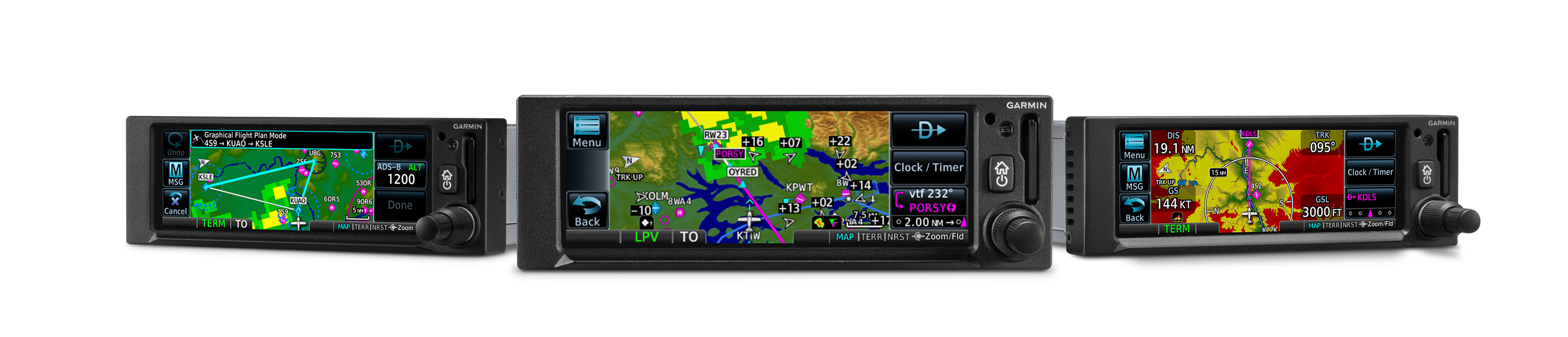

More capabilities at your fingertips.
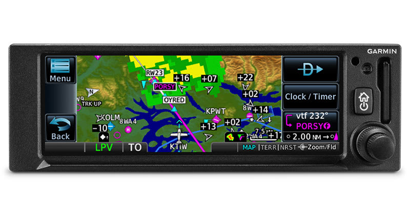
MULTIFUNCTION DISPLAY
The 4.8-inch display puts moving maps, terrain, traffic and weather 1, SafeTaxi® airport diagrams and more at your fingertips.
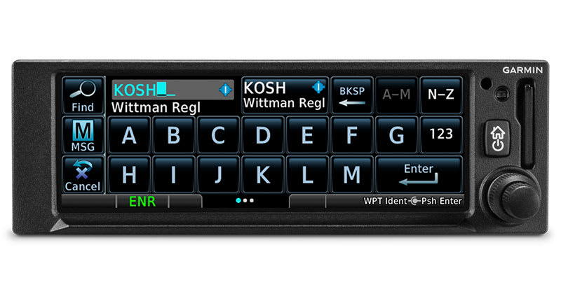
EASY DATA ENTRY
Use the on-screen keyboard or traditional concentric knobs to enter waypoint identifiers, routings and more.
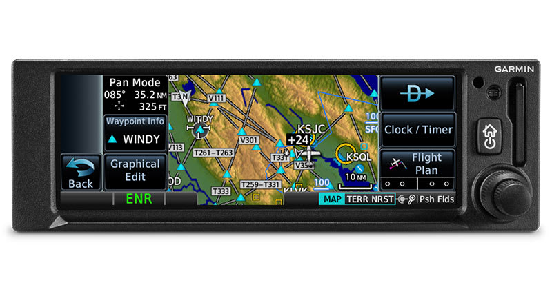
PINCH, SWIPE GESTURES
A quick finger swipe lets you pan across the map display. Or use a smartphone-like pinch-to-zoom motion to scale up or down on any map, traffic1 or terrain page.
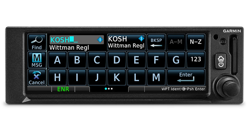
FASTFIND FEATURE
As soon as you start typing, the GPS 175 navigator's FastFind feature uses quick predictive logic to suggest airport and waypoint entries by using current GPS position. Just select and go.
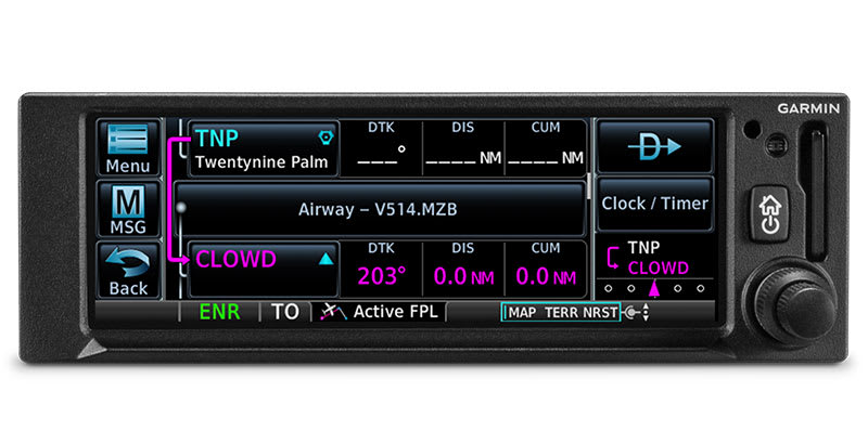
AIRWAYS, YOUR WAY
Victor airways can be overlaid on the map. For easy IFR routings, view airway segments available from a waypoint and corresponding exit options.
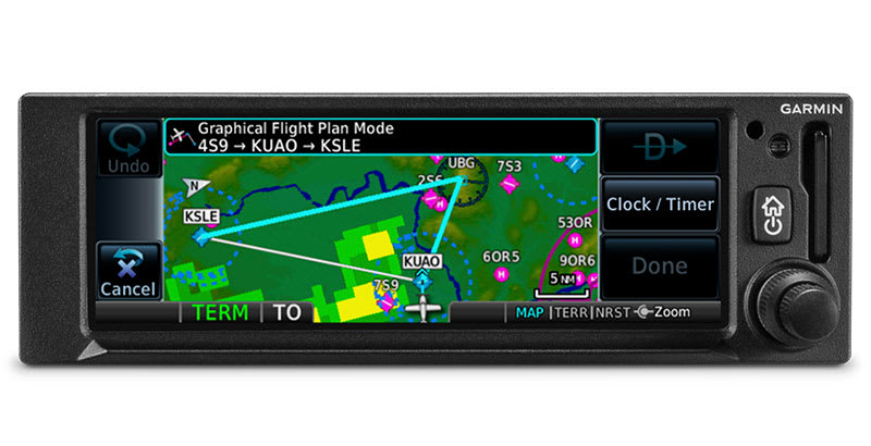
“RUBBER BAND” REROUTES
This handy feature lets you grab a flight plan leg on the screen and then stretch or move it to adjust for a deviation or ATC amendment to your flight plan.
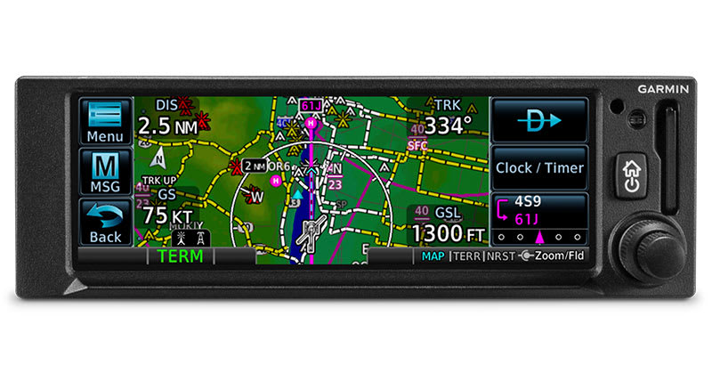
VIRTUAL MAP TOPOGRAPHY
By referencing built-in terrain, mapping and obstacles databases, GPS 175 shows detailed surface features, cities, airports, SUAs and more on the dynamic map display.
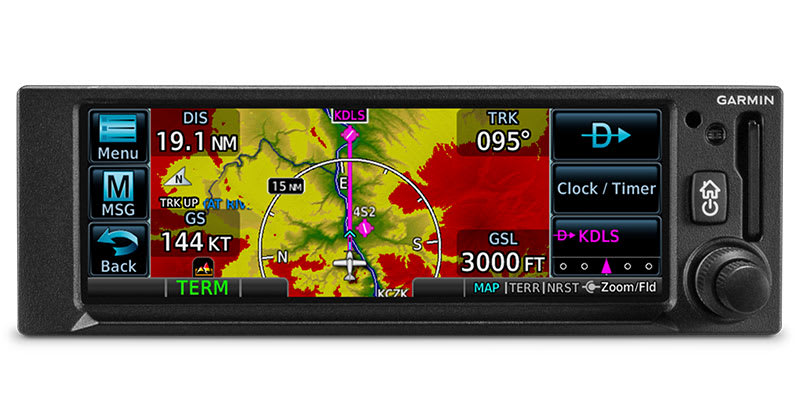
TERRAIN ALERTING
A built-in database provides color-coded display overlays to warn when potential terrain conflicts loom ahead.
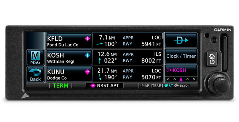
DIRECT CONNECT
A Direct-to key on almost every page lets you quickly enter a direct course for any selected waypoint. A menu of nearest airports and flight plan waypoints makes for easy entry.

Intuitive navigation to more airports.
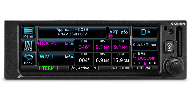
MORE APPROACH OPTIONS
The WAAS/SBAS-certified GPS receiver enables GPS-guided LPV glidepath approaches down to ILS-comparable minimums as low as 200'.
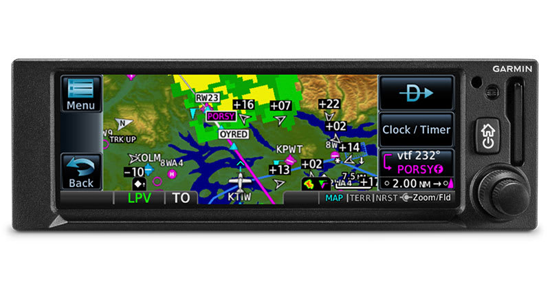
CLEARED FOR THE VISUAL
GPS 175 can give advisory visual approach guidance based on a published glidepath or a 3-degree slope from the runway threshold (with terrain/obstacle clearance).
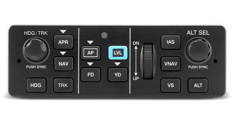
AUTOPILOT INTERFACE
Precise course deviation and roll steering outputs can be coupled to Garmin autopilots and select third-party autopilots, enabling virtually all IFR flight procedures to be flown automatically.
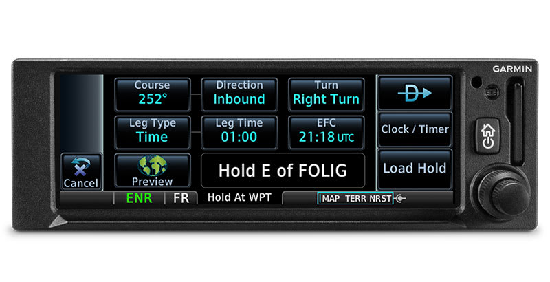
HOLDING PATTERNS
IFR pattern entries can be tricky. The GPS 175 navigator lets you easily create and execute holding patterns over a published or user-defined waypoint.
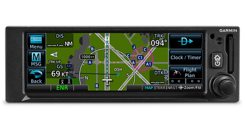
SAFETAXI DATABASE
Upon landing, georeferenced SafeTaxi diagrams on the display automatically help you track your location on hundreds of airports.
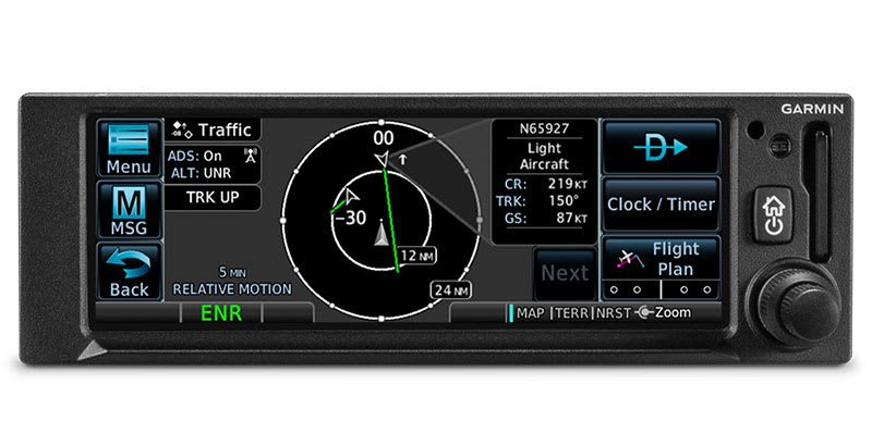
ADS-B DATA LINKS
When paired with a Garmin ADS-B “In” equipage solution2, GPS 175 can display up to 60 ADS-B traffic targets as well as subscription-free U.S. weather data.
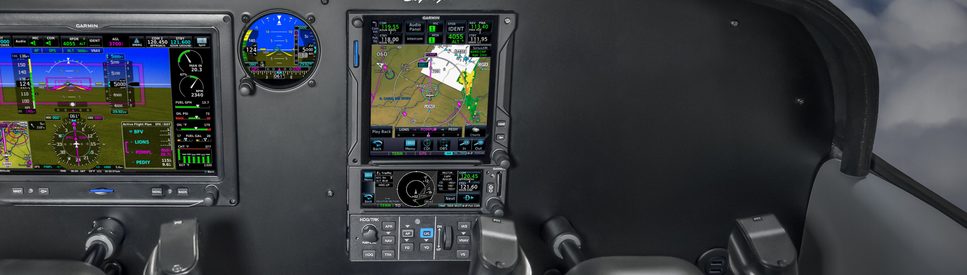
Your hub for flight information.
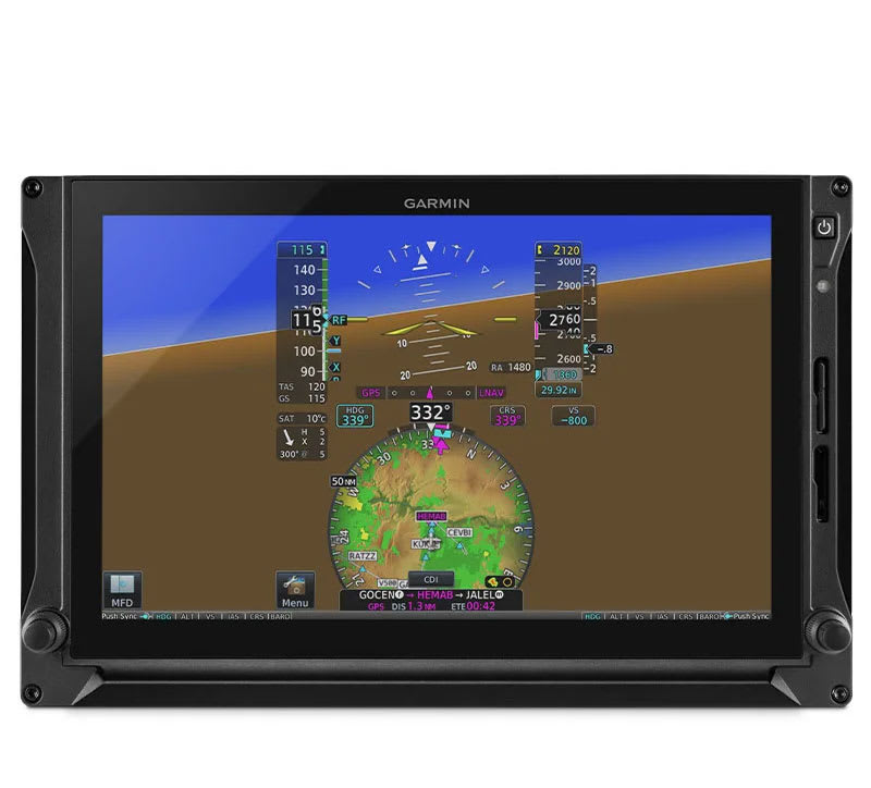
PANEL INTEGRATION
The GPS 175 navigator interfaces with Garmin flight displays, including AXIS™, G3X Touch™ (experimental and certified), G5 (experimental and certified), G500/G600, G500 TXi/G600 TXi and select third-party displays3 to provide navigation outputs.
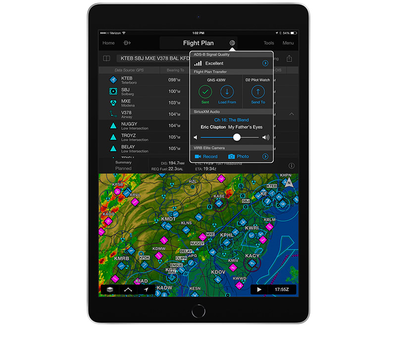
CONNECT YOUR COCKPIT
Use built-in Connext technology to stream information between GPS 175 and your compatible Garmin portables or mobile devices running the Garmin Pilot or ForeFlight apps2. You can stream GPS data and back up attitude data to your device in real time.
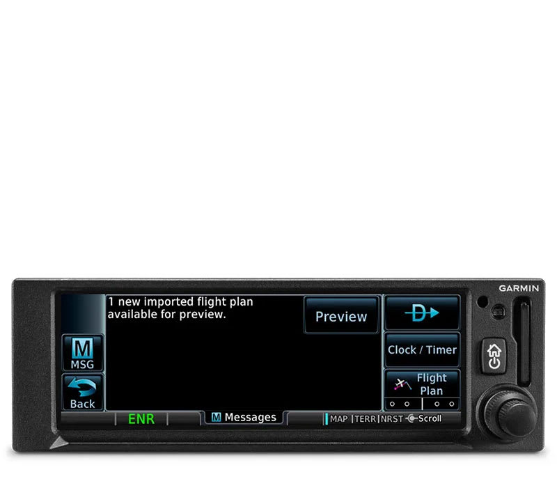
FLIGHT PLAN TRANSFER
Save time by creating your flight plan on your mobile device at home, then use built-in Connext technology to wirelessly upload the data into your GPS 175 during preflight at the airport.
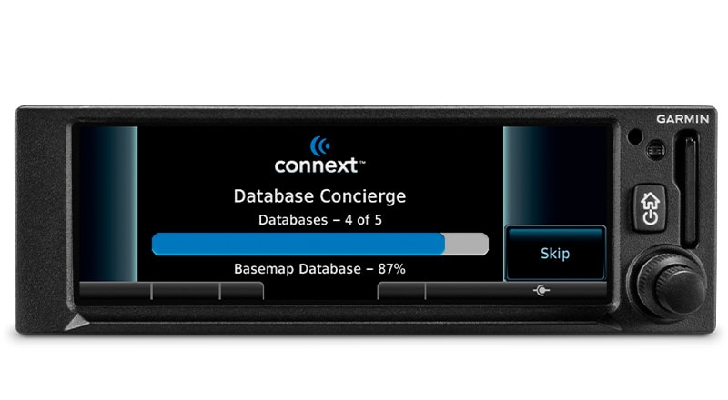
EASY DATABASE UPDATES
Install a Flight Stream 510 gateway to add Database Concierge to your GPS 175 navigator. Upload databases from your tablet in minutes — then let automatic sync with your compatible avionics do the rest.
TRAINER APP
A free iPad® Trainer app is available on the App Store®. Get familiar with the product, even before you buy!
- When properly equipped
- Requires compatible ADS-B “In” source; sold separately
- Reference the supported Interfaces tab for compatibility details
- TSO applicability: C146e Class 3; C157b Category 1; C165a; C195b Category B1, B3, B5, B7
- Display size: 4.8" (122.5 mm) diagonal
- Display resolution: 732 pixels (W) x 240 pixels (H)
- Unit bezel height: 2.02" (51.0 mm)
- Unit bezel width: 6.25" (159.0 mm)
- Unit depth with connectors: 6.58" (167 mm) (measured from face of aircraft panel to rear of connector backshells)
- Unit weight: 1.3 lbs (0.6 kg)
- Maximum altitude: 35,000 ft
- Input voltage range: 9 VDC - 33 VDC
- Maximum display brightness: 260 fL
- Operating temperature range: -20° C to 55° C (-4° F to 131° F)
- Bluetooth version: 4.2
- Number of GPS channels: 15 (12 GPS and 3 GPS/WAAS/SBAS)
- LAT/LON position accuracy: <1.25 meter RMS horizontal, < 2 meter vertical, with WAAS
- Maximum velocity: 1,000 knots (above 60,000 feet)
- Position update Interval: 0.2 sec (5 Hz)
Interfaces
Garmin products have been designed for compatibility with a wide range of avionics. To confirm compatibility of Garmin equipment with your specific aircraft make/model and current avionics configuration, please consult your Authorized Garmin Dealer.
Interface |
Manufacturer |
Model |
Autopilots |
Honeywell (Bendix/King) |
KAP 100/140/150, KFC 150/200/250 |
KFC 225/275/325 | ||
Century |
I/II/III/IV, 21/31/41, 2000, Triden |
|
AK 1081 1 | ||
S-TEC |
System 20/30/40/50/55/60-2/60 PSS/65 |
|
System 55X | ||
ST-901 1 | ||
Cessna |
300B/400B/800B |
|
300 IFCS/400 IFCS | ||
Garmin |
GFC 500 |
|
GFC 600 | ||
Navigation Indicators |
Garmin |
GI 106/106B (IFR) |
GI 102/102A (VFR) | ||
Honeywell (Bendix/King) |
KI 204/209/209A (IFR) |
|
KI 203/208/208A (VFR) | ||
KI 206/209A/525A, | ||
KI 202/208A (VFR) | ||
ARC (Cessna) |
IN-386A, IN-481AC (IFR) |
|
IN-385AC (VFR) | ||
Century |
NSD 360A, NSD 1000 (IFR) |
|
Collins |
331A-6P, PN-101, IND-351D (IFR) |
|
S-TEC |
ST 180 (IFR) |
|
Mid Continent |
MD222-406, MD200-306, MD200-307 (IFR) |
|
MD222-402, MD200-302, MD200-303 (VFR) | ||
Narco |
VOA 9/50M (IFR) |
|
VOA 8 (VFR) | ||
EFIS Displays |
Aspen |
EFD 1000/500 |
Garmin |
G500/G600 |
|
TXi Series | ||
G5 (ADI) | ||
G3X Touch | ||
EHSI Displays |
Garmin |
G5 (HSI) |
Sandel |
SN 3308 |
|
SN 3500/4500 | ||
Heading Reference Sources |
Aspen |
EFD 1000 |
Garmin |
GAD 42 |
|
G500/G600 | ||
TXi Series | ||
Sandel |
SN3500 |
|
SN3308 | ||
Multifunction Displays |
Garmin |
GMX 200 |
MX20 | ||
Datalinks |
Garmin |
GDL 82 |
GDL 88/88D | ||
Transponders |
Garmin |
GTX 327 |
GTX 328 | ||
GTX 330/330D | ||
GTX 330/330D w/ES | ||
GTX 335 | ||
GTX 345 |
Connext® Compatibility
Enabled with BLUETOOTH® wireless technology.
aera® 796/795/660 |
Garmin Pilot™ |
FltPlan Go |
|
Backup Attitude |
X |
X |
X |
GPS Position |
X |
X |
|
Flight Plan Transfer |
X |
X |
X |